Walling Map (1851)
Walling Map (1851)
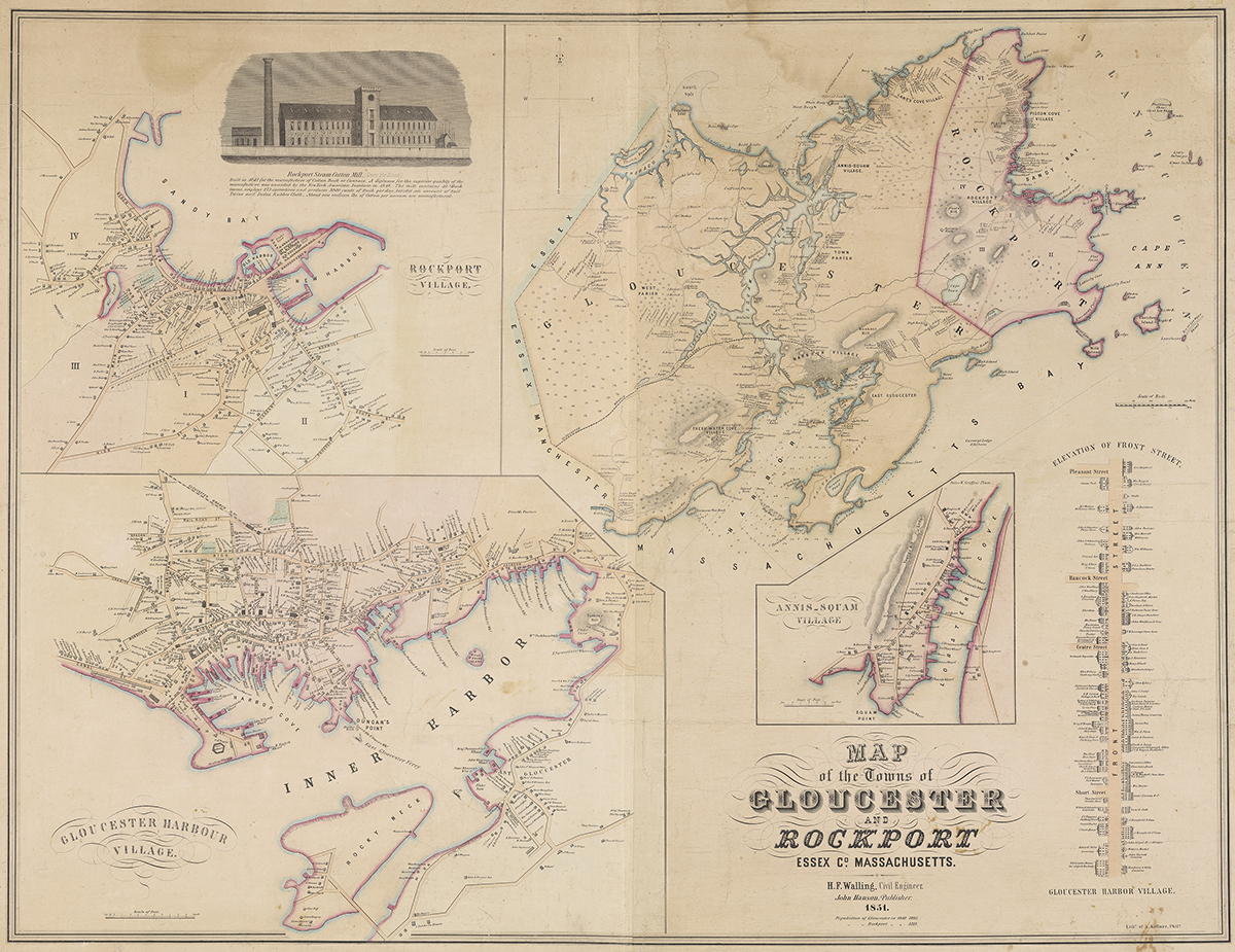
Map of the Towns of Gloucester and Rockport
Created by Henry Francis Walling (1825–1888). Walling began his map-making career as an assistant surveyor for the town of Providence, RI. He later moved to New York and then to Boston where he started his own cartography business. Through contracts with town and county officials Walling eventually published over 400 maps — 20 state and province maps, 280 county maps and over 100 town and city maps like this one.
The Walling Map gives us a snapshot of life on Cape Ann — its businesses and residents in particular — prior to the start of the Civil War and before the introduction of City Directories in 1860. Furthermore, it allows us to identify the location of a particular house or business by the owner’s name — or conversely to find the name of any particular building’s owner.
Conservation of this map was partially funded through a grant from the City of Gloucester Community Preservation Act.